
length
11 Days
difficulty
Moderate - Challenging
trip cost
from $3350 pp
Nature Immersion
Cultural Interest
Overview
Scotland's West Highland Way
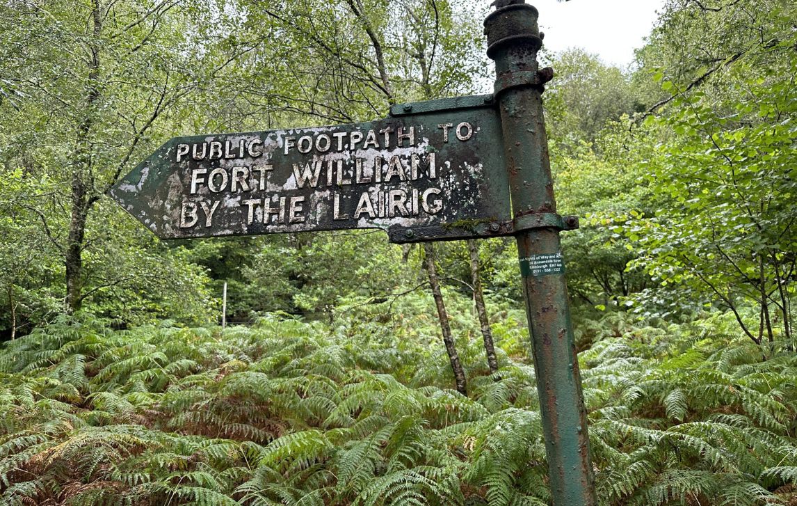
The West Highland Way is Scotland’s most iconic long-distance trail, stretching 155km from Milngavie (pronounced Mill-guy) near Glasgow to the foot of Ben Nevis in Fort William.
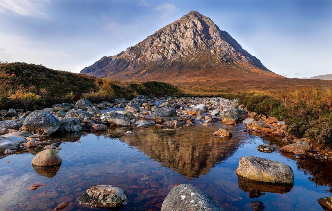
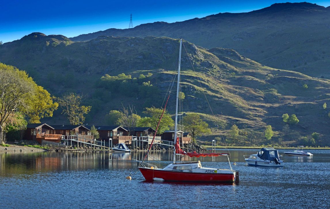
The trail is often described as breathtaking. Gentle farmland and rolling hills give way to the wooded shores of Loch Lomond, then onto the haunting expanse of Rannoch Moor and the dramatic peaks of Glencoe. Each day offers something different, from open moorland and rugged mountains to tranquil villages, creating a sense of discovery that keeps walkers returning.
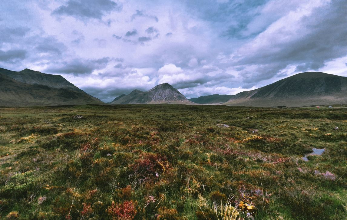
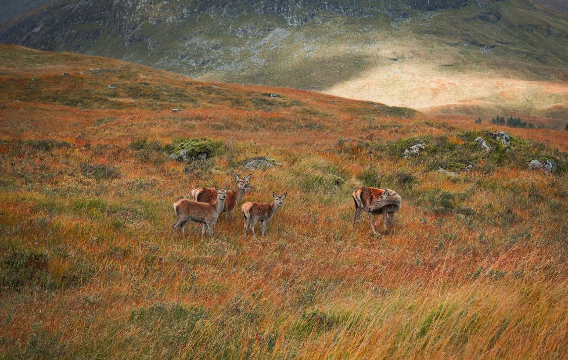
The Loch Lomond section can divide opinion. For some walkers, this is their favourite section. Some love the shoreline views while others find its meandering, rocky paths a test of patience. Rannoch Moor and Glencoe, on the other hand, feel vast and untamed, with red deer a common sight on distant slopes. In summer the infamous midges remind you that you’re deep in the Highlands.
This is a walk of camaraderie as much as scenery. You’ll meet other walkers on the trail, in villages and pubs, sharing stories, encouragement and laughs. By the time you reach Fort William, the sense of achievement is unforgettable.
The West Highland Way is more than just a walk. It’s a journey into the heart of the Highlands.


Highlights
Get Ready For
- Hike Scotland’s classic long-distance route
- Wander the bonnie wooded banks of the famous Loch Lomond
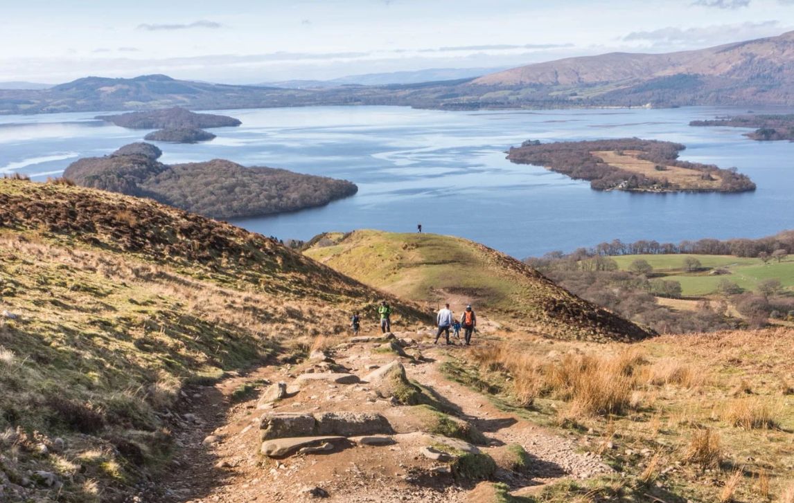
- Climb iconic Conic Hill for the views that made it famous
- Cross the haunting Rannoch Moor, framed by the legendary peaks of Glencoe
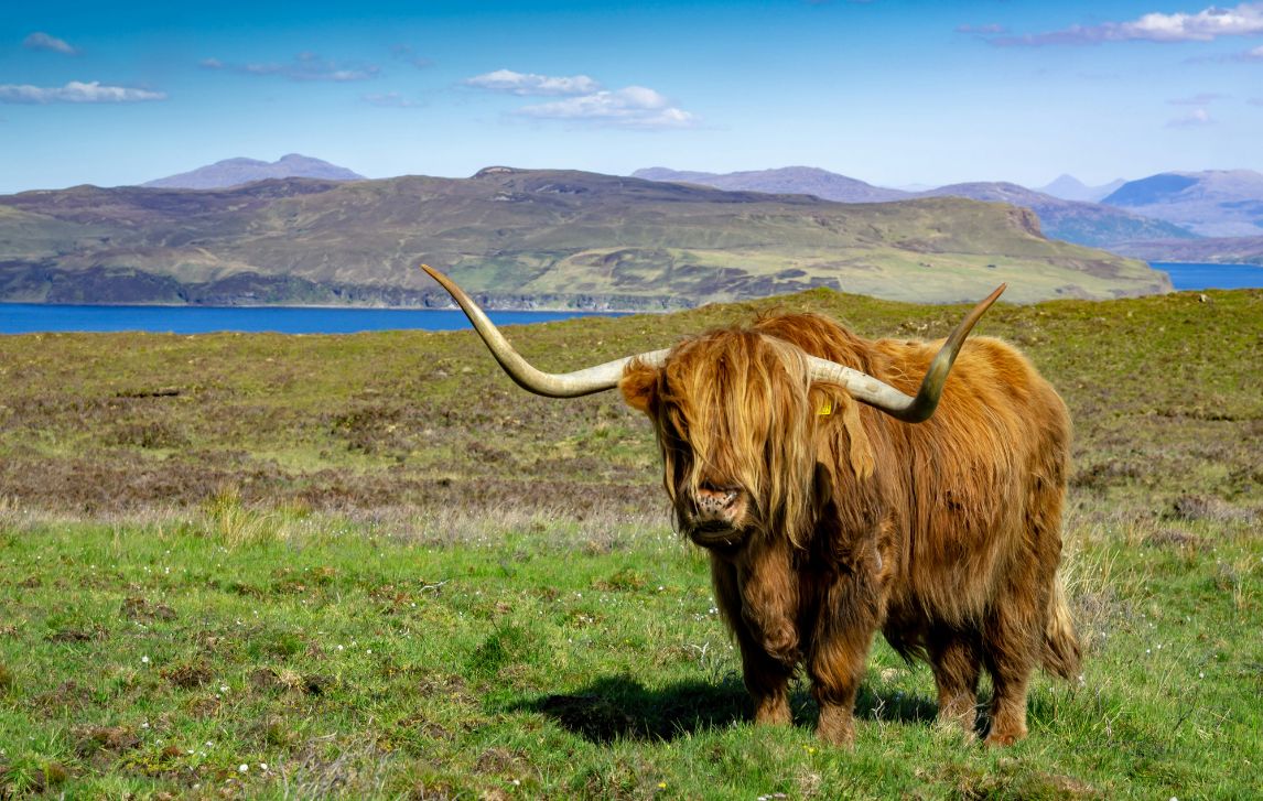
- Spot red deer, shaggy Highland coos and soaring raptors
- Enjoy drams of whisky or a local ale in cosy inns
- Share the Camino-esque trail camaraderie without the crowds
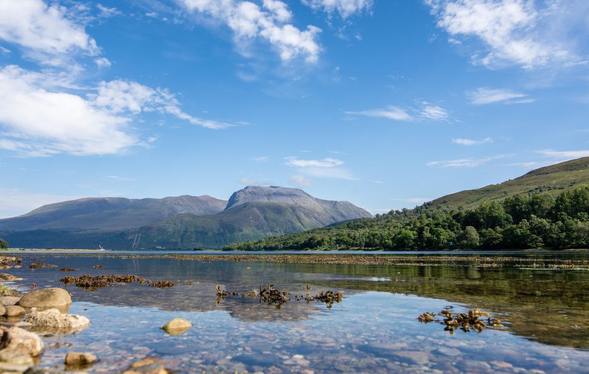
- Celebrate in Fort William with majestic views of Ben Nevis, Scotland’s highest mountain
ON THE TRAIL
What it's like underfoot
Underfoot you will generally find good, well-maintained paths. The terrain includes wide forest tracks, moorland, hillside paths and fields, with some boggy areas and narrow trails with tree roots that add character to the walk. Take care after rain as roots, stones and wet grass can be slippery, especially the descent from Conic Hill. Rockier or steeper sections are short-lived, though areas around Loch Lomond and Rannoch Moor require steady footing and high-quality footwear with Vibram soles. Gentler lowland paths and village tracks offer relief and moments to savour the scenery. Even the most strenuous section and highpoint, the Devil’s Staircase at 548m, feels rewarding. The unforgettable views and sense of achievement make every step worth it.
Itinerary
DAILY DETAILS
Day 1: Arrive Milngavie
Milngavie (pronounced Mill-guy) is a small quiet village just outside Glasgow. It somehow feels both sleepy and like it’s waiting for something to happen. The streets have a few cafés and shops and in the centre a granite obelisk marks the start of the West Highland Way. It’s a welcoming place to settle in and get your bearings before tomorrow’s first steps along Scotland’s most famous long-distance trail.
- Overnight: Milngavie
- Meals: B
Day 2: Walk Milngavie to Drymen (19km)
Your first full day on the West Highland Way is relatively flat and starts with a gentle meander towards Mugdock Country Park. The path is well-trodden with the occasional squirrel darting across your way and sheep that seem to stare a bit too long. You pass Mugdock Castle, its ruins tucked among the greenery, and pretty Craigallian Loch home to the legendary campfire of the depression era that reputedly burned for almost 20 years.
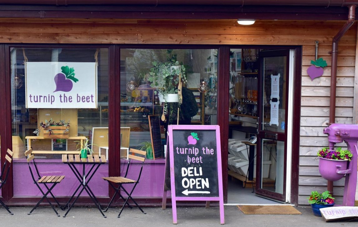
Further along the trail skirts Glengoyne Distillery with the scent of malted barley in the air and classic distillery buildings that make for a tempting photo opportunity. Just past the distillery the Beech Tree Cafe offers an inviting spot for a break, especially if the beer garden is sunny. Also keep a look out for Turnip the Beet, a quirky deli offering delicious home cooked food.
The day finishes along quiet country lanes into Drymen, a friendly village with stone cottages, cafés, and pubs.
- Overnight: Drymen
- Grading: Moderate
- Elevation gain: 250m
- Meals: B
Day 3: Walk Drymen to Balmaha (11.5km)
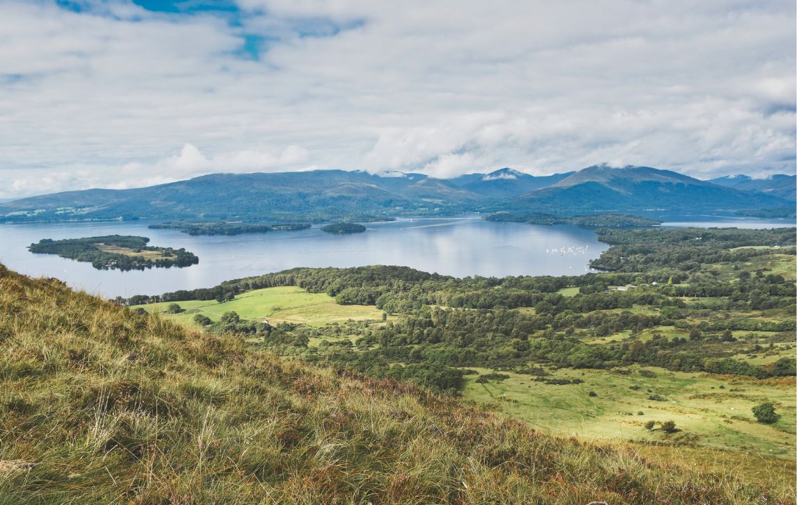
After leaving Drymen the path winds its way through Garadhban Forest, a quiet stretch of pines, before starting the climb up Conic Hill, the first real ascent of the trail and a moment many walkers remember as their highlight. It’s not a huge mountain (361m) but it feels like a proper climb.
The views over Loch Lomond and the Trossachs National Park are truly awe-inspiring and showcase the stunning scenery that makes discovering Scotland so special. Beyond the loch, the hills stretch into the distance, a patchwork of craggy peaks and green valleys, marking the start of the real Highlands.
The descent from Conic Hill can be slippery in wet weather, so take it slow and consider using hiking poles. If the weather looks challenging, the easier route to Milton of Buchanan provides a safer, lower path through quiet fields and woods.
Whichever trail you’ve chosen, it will lead you into Balmaha, a delightful village on the shores of Loch Lomond. After the climb and those epic views, it’s the perfect spot to kick off your boots and grab a coffee or a pint. Local stalls and craft shops line the street, and every so often you catch a knowing glance from a fellow walker – a silent nod that today was the day you ‘conquered’ Conic Hill.
- Overnight: Balmaha
- Grading: Challenging
- Elevation gain: 430m
- Meals: B
Day 4: Walk Balmaha to Rowardennan (11km)
While this is a relatively short day, the terrain can be challenging. The trail hugs the loch in places with rocky stretches and occasional slippery paths, making it demanding for some walkers. However, many consider it one of the most scenic sections of the trail, with the constant company of the loch and its wildlife. This stretch is renowned for its rich biodiversity. In spring and summer you can enjoy wildflowers like orchids and primroses while the loch’s waters teem with birdlife, including ospreys, herons and the occasional otter – a perfect example of Scotland’s natural beauty.
Just offshore, a highlight of this section is Inchcailloch Island, a tranquil spot steeped in history. The name ‘Inchcailloch’ translates to ‘Island of the Old Woman,’ believed to refer to St Kentigerna, an 8th-century Irish missionary who lived there. The island was once home to a nunnery and later served as a burial ground but today is a haven for walkers.
There’s a bit of road walking as the trail threads through small settlements but it offers a chance to catch your breath, experience genuine Scottish hospitality and take in the stunning scenery before finishing in the tiny hamlet of Rowardennan.
- Overnight: Rowardennan
- Grading: Challenging
- Elevation gain: 250m
- Meals: B
Day 5: Walk Rowardennan to Ardleish Ferry (20km) or Inverarnan (23km)
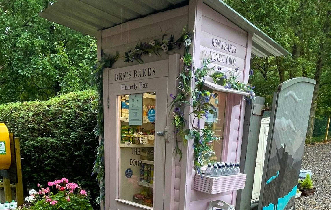
As you leave Rowardennan, head north toward the car park where you’ll find Ben’s Bakes, one of the cutest honesty boxes on the trail tucked into a pink telephone box. We love this one!
Shortly after, the trail splits. The official route hugs the shores of Loch Lomond, rugged and rewarding. The higher forestry trail offers a gentler climb and a bit more shelter. Both paths meet again just before Rowchoish Bothy, a handy landmark on this quiet stretch.
The shoreline trail becomes uneven underfoot, with occasional muddy patches that demand attention, especially after rain. Not far past Inversnaid, you’ll come across Rob Roy’s Cave. History says Robert the Bruce once sought refuge here after the Battle of Dalry in 1306. A hand-painted “CAVE” marks it clearly among the jumble of boulders.
The day finishes in Inverarnan, where the historic Drovers Inn, established in 1705, awaits. Originally a stopping point for Highland drovers bringing cattle to market, it has retained much of its old-world character. Inside, low-beamed ceilings, roaring fires, quirky taxidermy and historic relics transport you back in time. Ghost stories linger, making it more than just a place to rest. It’s a true slice of Highland history.
- Overnight: Ardlui Hotel/Inverarnan
- Grading: Challenging
- Elevation gain: 350m
- Meals: B
Day 6: Walk Inverarnan to Tyndrum (19km)
Leaving Inverarnan (add 3km if you stayed overnight at the Ardlui Hotel), you follow a gentle path that runs alongside the River Falloch. The walking is pleasant and largely undemanding, which makes this section feel easy underfoot. It’s not long before you notice the first signs that you’re crossing the halfway point of the West Highland Way as the hills of the Highlands rise more prominently in the distance, while Loch Lomond fades from view.
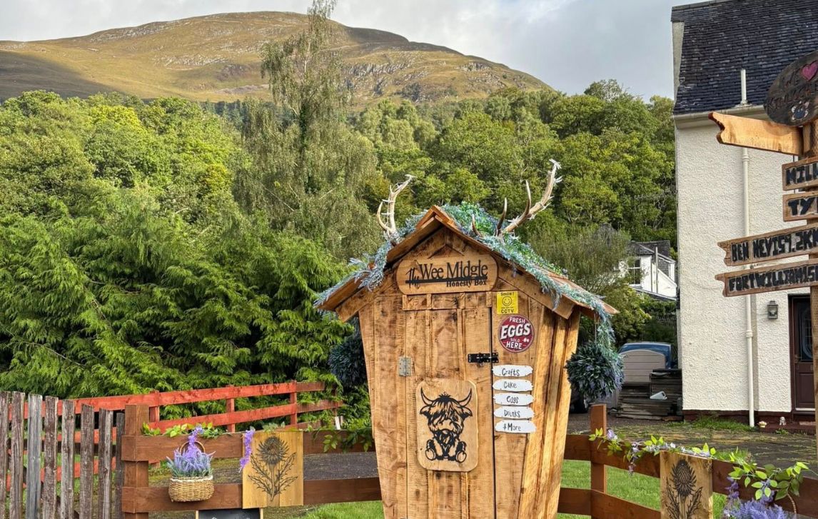
The trail passes through fields dotted with sheep and Highland cattle, giving a charming, very Scottish backdrop to your walk. Near Crianlarich, you might notice remnants of old railway cuttings and bridges, subtle hints at the area’s industrial past. The village itself is slightly off the trail but offers a welcome stop for lunch, supplies and a coffee break. A few small honesty boxes along the way sell fresh produce or baked goods.
As you continue past Crianlarich, the route gently undulates through open glens with the Highlands steadily drawing closer. The day finishes in Tyndrum, a small village with a couple of cafés and pubs. After a pleasant day’s walking, it’s the perfect place to rest, enjoy a hearty meal and reflect on reaching the halfway mark of Scotland’s iconic trail.
- Overnight: Tyndrum
- Grading: Moderate
- Elevation gain: 470m
- Meals: B
Day 7: Walk Tyndrum to Bridge of Orchy (11.5km) or Inveroran (15km)
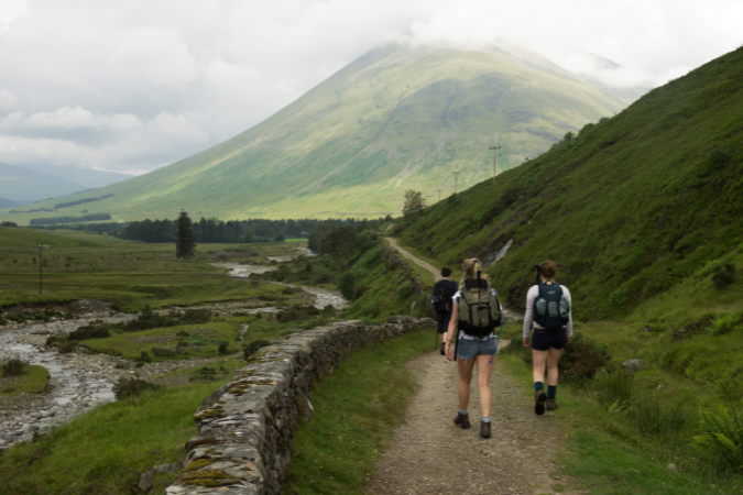
From Tyndrum, the landscape begins to change dramatically and the West Highlands finally feel real. Peaks rise sharply ahead, with Ben Dorain (1076m) dominating the skyline, tempting you to pause and take in its scale. The trail follows the old military road, winding alongside the River Orchy, a constant companion as you make your way through the glen.
The walking is pleasant on well-defined paths through moorland and scattered woodlands. Along the way look for the little stone bridge tucked into a grove of trees, a charming reminder of the trail’s character, and don’t forget to watch for red deer, the occasional mountain hare or other wildlife.
The views open as you walk, giving way to sweeping valleys and rivers tumbling over rocks. From certain vantage points, you can glance back toward Loch Lomond, now far behind you. It’s a day of contrast with calm stretches alongside rivers, dramatic peaks ahead and reminders that the Highlands you’ve imagined are finally here.
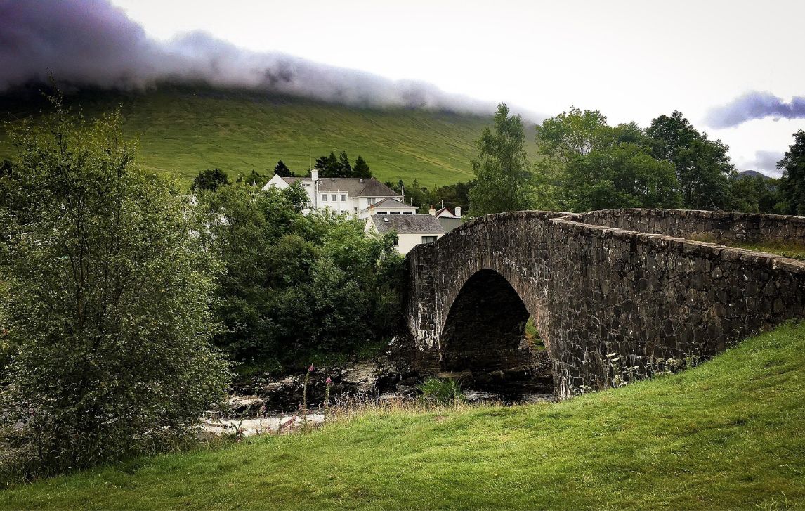
The day finishes at Bridge of Orchy, a tiny village with a handful of cafés nestled on the banks of the River Orchy. Depending on accommodation availability, some walkers may need to continue a little further across stunning moorland to the village of Inveroran.
- Overnight: Bridge of Orchy/Inveroran
- Grading: Moderate
- Elevation gain: 230m
- Meals: B
Day 8: Walk Bridge of Orchy to Kingshouse (19.5km)
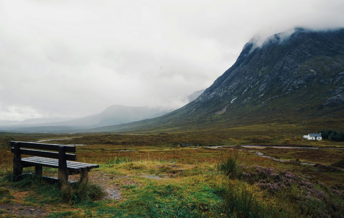
Today the trail opens into something vast and elemental the moment you step onto the moor. Pretty Loch Tulla lies ahead, framed by the towering slopes of Black Mount, while distant peaks hint at the drama of Glencoe to come. There’s a quality to this land that feels ancient and primeval, a place that seems to have held its breath for centuries.
The route continues along the old military road, steady underfoot, but it’s the space around you that captivates. The endless moorland of Rannoch, the distant mountains and skies so wide that even the tallest peaks feel small. Weather here can shift in an instant, so be ready for wind, rain and sun. Carry your lunch, plenty of water and some good quality snacks, as there are no stops until Kingshouse.
Along the way, subtle landmarks appear, including the ruins of an old church and a lone stone bridge tucked into a grove. Glancing back, Loch Tulla fades behind you, while the moors and mountains ahead promise solitude, drama and a sense of timelessness. By the time you reach Kingshouse, you’ve walked a section that isn’t just traversed – it’s felt. A remarkable stretch of the West Highland Way that stays with you long after you leave it.
- Overnight: Kingshouse
- Grading: Moderate
- Elevation gain: 380m
- Meals: B
Day 9: Walk Kingshouse to Kinlochleven (14.5km)
Kingshouse sits among some of the Highlands’ most dramatic scenery and today the trail unfolds into one of its most beautiful stretches of the entire walk. Ahead you can see Buachaille Etive Mor, one of the most famous mountains in Glencoe, whose Gaelic name means ‘the great herdsman of Etive’.
The climb up the Devil’s Staircase (550m) awaits, its fearsome name inherited from the soldiers who first built and marched this route—struggling up the slope and naming it accordingly. In truth, the ascent isn’t nearly as menacing as its title suggests. From the top, Glen Coe Valley stretches behind you while the moor ahead opens out and the route drops toward Kinlochleven. On a clear day, you might even catch sight of Ben Nevis on the distant skyline.
The descent winds steadily into Kinlochleven, a working Highland village offering warm Scottish hospitality, nestled among steep hillsides and forest. It may not have the same charm as some of the villages you’ve passed but after such an inspiring day it’s a satisfying place to pause before your final stage of the West Highland Way.
- Overnight: Kinlochleven
- Grading: Moderate to Challenging
- Elevation gain: 440m
- Meals: B
Day 10: Walk Kinlochleven to Fort William (24km)
You leave Kinlochleven and start the steady climb out of the village along forest tracks and open paths. The trail varies from gravel, rocks, soft soil and the occasional muddy patch. It’s manageable and every step feels worth it.
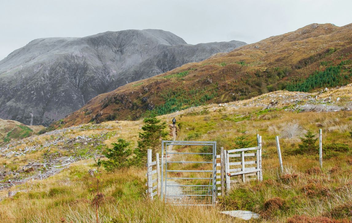
As you climb, the mountains rise sharply ahead with Ben Nevis (1345 m), the UK’s highest peak, dominating the skyline. Even from a distance, its scale is impressive and it’s impossible not to pause and take it in – the Highlands’ stunning scenery on full display.
The trail drops into Glen Nevis, a lovely sheltered valley with wooded glens and open pastures, before joining the canal path into Fort William. The town is a busy Highland hub, with cafés, pubs and shops – a lively contrast to the quiet of the trail.
The walk finishes at the famous West Highland Way statue, officially called the “Man with Sore Feet”. The bronze hiker sits on a bench, one boot off, rubbing his foot – a scene every walker can relate to. Most pause here to take a photo, rest and swap a few words or laughs with fellow walkers about the journey, before settling down to reflect on the landscapes you’ve crossed and the people you’ve met along the way.
- Overnight: Fort William
- Grading: Challenging
- Elevation gain: 580m
- Meals: B
Day 11: Depart Fort William
Your time on the West Highland Way comes to an end in Fort William. Take a deep breath, savour the last views and carry the memories of the trail with you as you go.
Meals: B
Carbon footprint & our regenerative actions
19kg of CO2-e per person per day
We pay for a monthly offset to cover the estimated emissions of our walkers for all trips with RAW Travel, which goes into local reforestation or biodiversity restoration. Explore the practical actions behind these estimated carbon offsets for your trip here, following a philosophy of ‘re-wilding the planet’ with native tree planting & Ocean plastic cleans ups.
A reasonable estimate for a pilgrim is 19kg of CO2-e per person per day, primarily due to hotels, meals and emissions from luggage transfers. The act of walking itself is a form of sustainable travel, so the carbon footprint calculated here is a measure of the ancillary activities surrounding the walk, not the walking itself. The figures are estimates, not precise measurements for each route/trip, as it’s difficult to provide an exact number without detailed data on specific hotels, menus, and transfer routes which vary from person to person. This figure represents the operational footprint of the hike and its included services only. It does not include the flights and other transport needed to get to the start and finish of the walk.
An individual can significantly influence their footprint with the varied choices they make around food and drink at each meal. For instance, a diet rich in meat, imported goods and alcohol, will have a much higher impact than one focused on local, seasonal, and plant-based options. This daily stated figure is an average across all days of the walk, derived from the key consumption components listed below.
| Component | Daily Estimate (kg CO2 | Notes on Itinerary Impact |
| Accommodation | 12kg | This covers 10 nights in small welcoming B&Bs, pubs, and inns. The quality of accommodation (private rooms) and the UK/Scottish energy grid mix make this the largest component. |
| Food (Breakfast Only) | 5 kg | Only a hearty daily breakfast is included. This figure accounts for the self-purchased lunches and pub dinners along the route, based on a typical UK diet. |
| Shared Luggage Transfers | 2 kg | Accounts for the necessary daily vehicle transport used to move your 20kg bag between accommodations along the linear 155km route. |
| Overhead & Miscellaneous | n/a | This is calculated & accounted for separately and includes emissions from waste, administrative operations, and general energy/water usage. |
| Total Estimated Daily Footprint | 19 kg | (Sum of the above) |
Map
West Highland Way Map
Glasgow
Glasgow is Scotland’s biggest city. It is a cosmopolitan and modern metropolis with an ornate historical facade, eclectic mix of trendy shopping malls, gothic architecture and concert halls. You can see Glasgow’s glorious past and exciting future on the River Clyde – the city straddles the waterway and there are plenty of striking modern structures along its banks.
CLICK ON A PIN TO REVEAL INFORMATION ABOUT THAT LOCATION
Milngavie
Milngavie is a charming and picturesque suburb on the outskirts of Glasgow. It is the official start point of the West Highland Way. The town centre is characterised by a charming, pedestrian-friendly high street lined with shops, cafes, restaurants, and boutiques.
Drymen
The vibrant village of Drymen sits in the hills at the western end of the Campsie Fells, overlooking the Endrick Water as it nears Loch Lomond. It has a great atmosphere and is a lovely location.
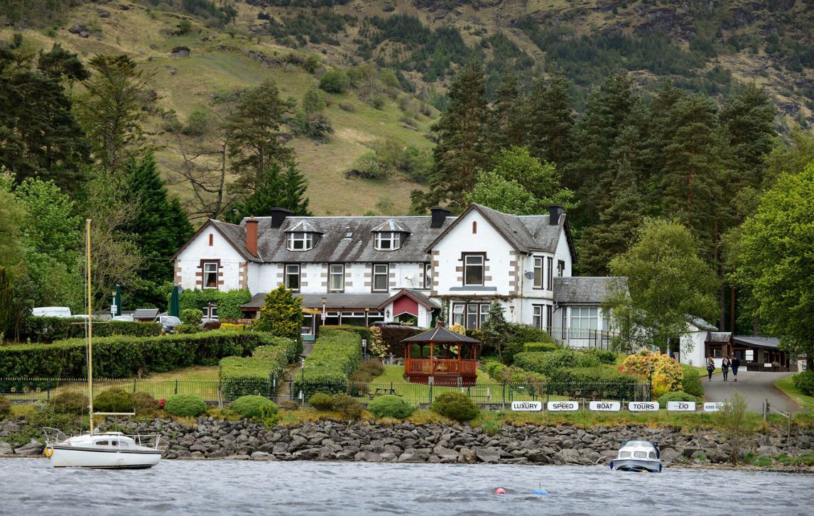
Rowardennan
Rowardennan is a small picturesque village situated on the eastern shore of Loch Lomond. You’ll find a lot of daytrippers basking up here on a sunny day.
Inverarnan
You’re truly in the Scottish Highlands now! Inverarnan is situated at the south end of Glen Falloch, on the shores of the River Falloch. It is a popular start point for climbers wanting to bag the Munros to the north of Loch Lomond.
Tyndrum
Tyndrum is a small village situated 5 miles north of Crianlarich in the heart of the hillwalking country around Glen Lochy.
Bridge of Orchy
This small highland village on the River Orchy, known for its historic bridge and stunning mountain backdrop. A classic stop along the West Highland Way.
Kingshouse
This historic inn and hamlet is set in the heart of Glencoe, offering a perfect stop for walkers on the West Highland Way with dramatic mountain views nearby.
Glencoe
In the heart of the Highlands, Glencoe is known for dramatic mountains, rare beauty and its haunting history. The amazing views of Buachaille Etive Mor dominate.
Kinlochleven
To reach the small village of Kinlochleven you need to tackle the biggest ascent of the West Highland Way – the Devil’s Staircase. At the top of the pass (547m) you will be rewarded with stunning views of Glencoe and Loch Leven.
Ben Nevis
At 1,344m above sea level, Ben Nevis is the UK’s highest peak. It offers stunning views and challenging hikes for adventurers.
Fort William
Fort William is the official end point of the West Highland Way, marked by a sign and a statue of a weary walker resting on a bench. You’ll be a bit tired but happy – and there are several pubs within easy walking distance!
Inclusions
What's Included?
Included
- Hassle-free walking using RAW Travel’s app, with access to your itinerary, accommodation, emergency contacts & weather information
- 10 nights quality accommodation small welcoming B&Bs, pubs and inns
- UK based RAW Travel support person
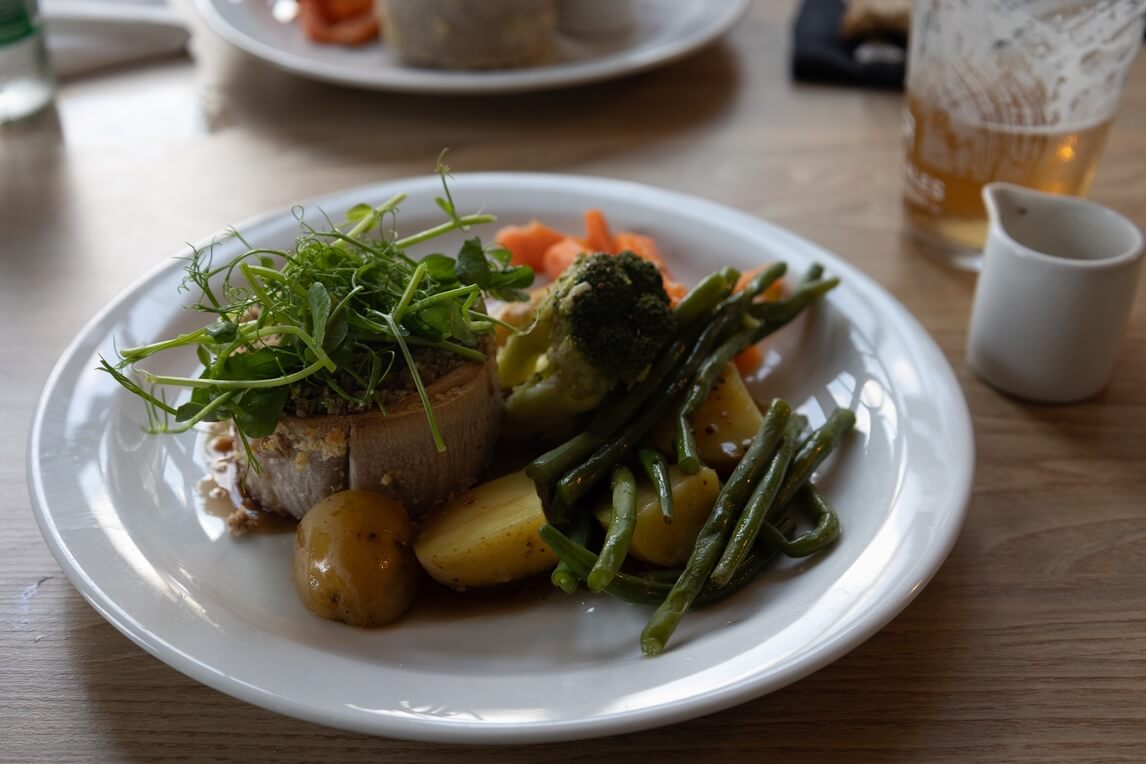
- Daily breakfast including a hearty cooked Scottish breakfast to support your day on the trail
- Pack-free walking with luggage transfers on each hiking day (1 x 20kg bag per person)
- RAW Travel hikers buff, luggage tag and dry bag
- Pre-trip guidance and planning from experienced and dedicated RAW Travel staff
- Carbon offset and a native tree planted on your behalf
Excluded
- Single supplement ($1795)
- Travel insurance
- Flights
- Lunch and dinners
- Taxi, bus, ferry fares

TRIP INFO & NAVIGATION
RAW TRAVEL APP
Our app gives you access to your itinerary, accommodation details, emergency contacts and weather information in one handy place. The ‘Route Maps’ feature helps with navigation when trail markings or signage is unclear or not available. You can also use it to find your accommodation and key points of interest. You still need to be self-reliant with wayfinding. As with any phone app, it’s not intended to be used constantly as you walk. For the best results with trail navigation, we recommend that you follow trail and road signs, and as a backup refer to a paper map or guidebook and our app. It’s essential to download and explore the RAW Travel app before your trip – it’s full of handy features to support your journey. Find out more here.
FAQS
West Highland Way – Frequently asked questions
How long is the West Highland Way?
It’s 155 km from Milngavie (pronounced “Mill-guy”) near Glasgow to Fort William. Most walkers take 10–11 days self-guided, though fitter hikers sometimes complete it quicker. We can tailor-make your itinerary to suit your needs and pace.
When’s the best time to walk the West Highland Way?
April to mid-October is the walking season. April brings increasing daylight, spring flowers and fewer crowds, though mornings can still be crisp. May is one of the busiest months, so expect more walkers. If this is your preferred time to walk it’s best to book with us early. June, July and early August can be warm and beautiful, but are peak midge season, so repellent or a head net is essential. September to early October offers autumn colours, cooler weather and generally fewer midges.
How do I get there from Australia?
Fly into Glasgow International Airport, usually via London, Dubai or Singapore. From there, a short train or bus ride of around 40–50 minutes takes you to Milngavie, the trail’s official start, where your adventure begins.
How do I get away from Fort William at the end?
- Train: Scenic West Highland Line to Glasgow or Mallaig. Book early in summer.
- Bus: Citylink buses to Glasgow or Inverness.
Is the West Highland Way a difficult walk?
Overall, it’s moderate. There are some steep climbs, including Conic Hill (361m) and the Devil’s Staircase (around 550m). Conic Hill is relatively short but steep, with fantastic views over Loch Lomond. The Devil’s Staircase is the highest point on the trail and a longer, more strenuous climb, offering spectacular Highland views. Some days are longer, but the paths are well marked. Good fitness, sturdy boots and trekking poles for descents will make your walk more comfortable and enjoyable.
Do I need to book my walk in advance?
Yes. To make sure we can secure your preferred dates, it’s best to book your walk around 12 months in advance. This is especially important if you’re walking with a larger group.
Are there places to get food and drink along the way?
Yes. Most villages have pubs, cafés or small shops. Some remote stretches, like Rannoch Moor, have no services, so carry snacks, lunch and water. Seasonal opening hours can affect availability, so it’s wise to check ahead.
How bad are the midges on West Highland Way?
Midges are tiny biting insects that appear mainly from June to early September, especially in damp, still weather, with peak activity in June and July. They can be irritating, but they’re not dangerous. Wearing long sleeves, using repellent, or carrying a head net usually keeps them at bay. They are most active in the early morning and late evening, so planning your walks during the day can help you avoid the worst of them. With a few simple precautions, you can enjoy Scotland’s stunning scenery without too much bother.
Do I need special equipment?
Sturdy waterproof boots with good grip with Vibram soles, good quality rain gear, layered clothing and a refillable water bottle are essential. Trekking poles can assist rocky or slippery descents.
What’s the highlight for most walkers?
For many, highlights include the rugged shoreline of Loch Lomond, the wide-open expanse of Rannoch Moor, the climb up Conic Hill and the final approach to Fort William with Ben Nevis rising in the distance. Walkers also often remember the friendly camaraderie along the way.
Is it similar to the Camino?
It’s shorter and wilder than the Camino – no daily cafes every few kilometres. You’ll still find camaraderie and a sense of kindred spirits with fellow walkers, which is one of the unexpected highlights of the walk. Expect rugged Highland hospitality instead of Spanish villages.
Is there public transport or taxis along the route?
Yes, but it’s limited. Trains connect Crianlarich, Tyndrum and Bridge of Orchy to Glasgow, handy in an emergency. Local buses run between some villages, though schedules are infrequent. Taxis can be arranged in larger villages, such as Crianlarich or Kinlochleven, but they can be costly.
What other walking holidays do you offer in the UK?
In addition to West Highland Way, RAW Travel offers many other walking holidays in the UK.
Hike across England on the iconic Coast to Coast Walk, discover the charm of the Cotswold Way or the South Downs Way, or walk England’s longest trail, the South West Coast Path, or discover Roman history on Hadrian’s Wall path.

Scotland
Arran Coastal Way – Scotland
- Explore ‘Scotland in miniature’ – highlands and lowlands
- Discover ancient stone circles and standing stones
- Look for seals, deer, eagles and native wildlife
- Visit local whisky distilleries
$2,250.00

Coast to Coast
Dales and Moors – Coast to Coast
- Walk quiet pathways of England’s most-loved national parks
- Discover the fascinating and mysterious Nine Standards Rigg
- Eat fresh local produce and sample regional ales and ciders
- Explore the almost 1000-year-old Richmond Castle
$3,495.00

Hadrian’s Wall
Hadrian’s Wall – East to West
- Marvel at 2,000 years of ancient Roman history
- Explore a ‘Frontiers of the Roman Empire’ World Heritage Site
- Enjoy Newcastles’ Victorian and post-industrial architecture
- Embrace the windswept solitude of Northumberland National Park
$2,295.00

Hadrian’s Wall
Hadrian’s Wall – West to East
- Hike through the wild Northumberland National Park
- Explore a treasure-trove of Roman artefacts
- Be amazed at the rich cultural heritage
- Enjoy a unique blend of history, culture and hospitality
$2,295.00
South West Coast Path
South West Coast Path: Jurassic Coast
- Walk 102km along Devon and Dorset’s spectacular Jurassic Coast
- Discover ancient rock formations and fossil-rich shores
- Explore idyllic seaside towns and picturesque fishing villages
- Immerse yourself in stunning landscapes and maritime heritage
$2,395.00

Cotswold Way
South Cotswolds – Cotswold Way
- Walk from charming Painswick to the elegant streets of Bath
- Explore honey-coloured villages and medieval market towns
- Follow the path through two butterfly conservation reserves
- Discover the ancient history of Neolithic Belas Knap
$1,995.00
TRIP date selection
when would you like to travel?
Please select your preferred dates for on-demand trips or select a scheduled date for group departures. If you have booked a self-guided trip please understand that because your trip date is on demand and we must check availability of all properties on your chosen dates before it can be fully confirmed