

length
8 Days
difficulty
Challenging - Strenuous
trip cost
From $2250pp
Nature Immersion
Cultural Interest
Overview
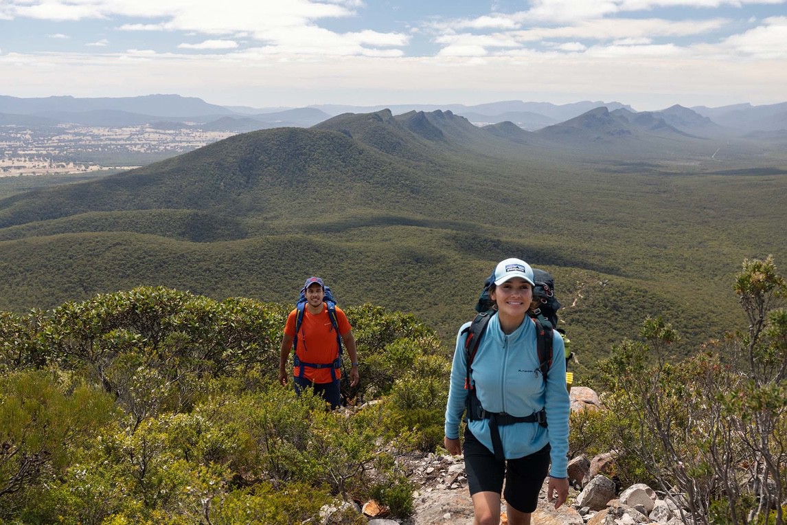
Grampians Peaks Trail 8 day Self-Guided
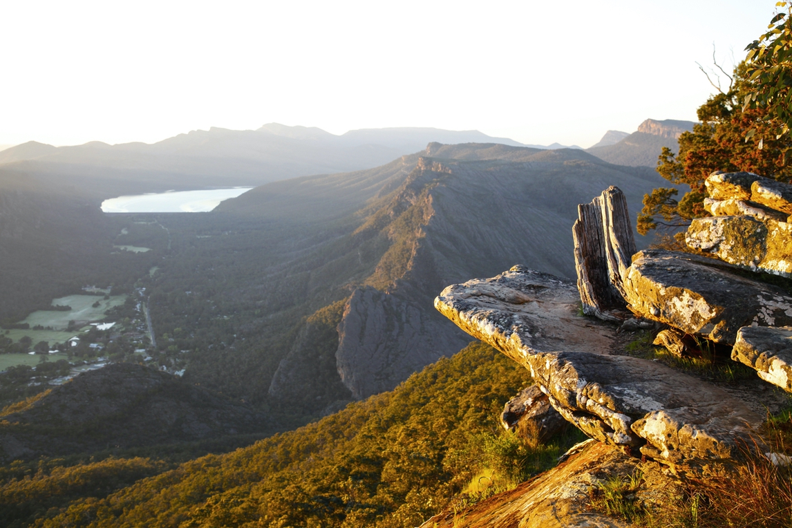
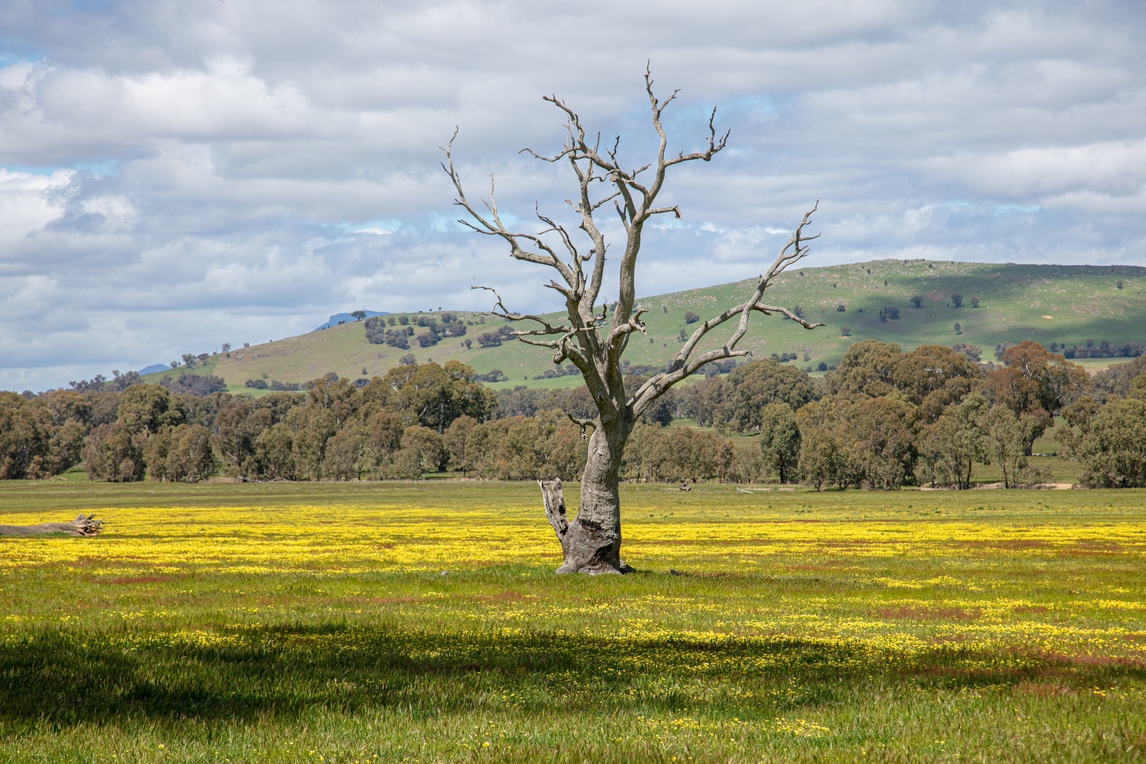
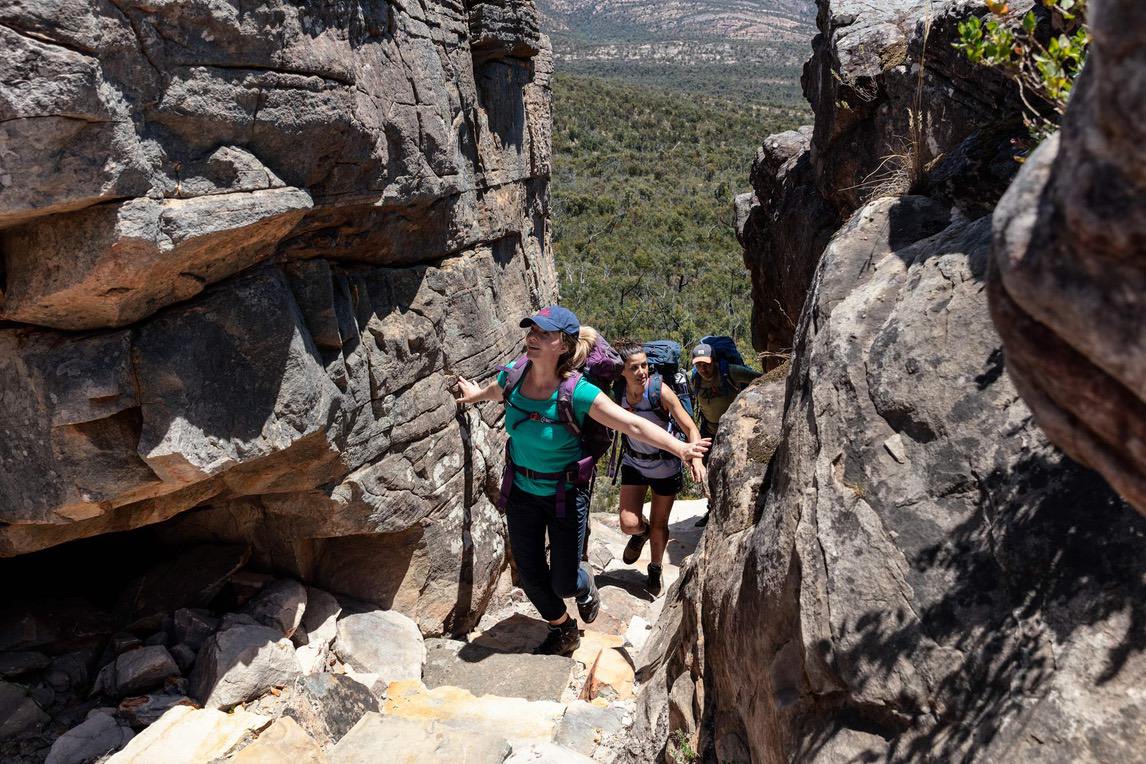
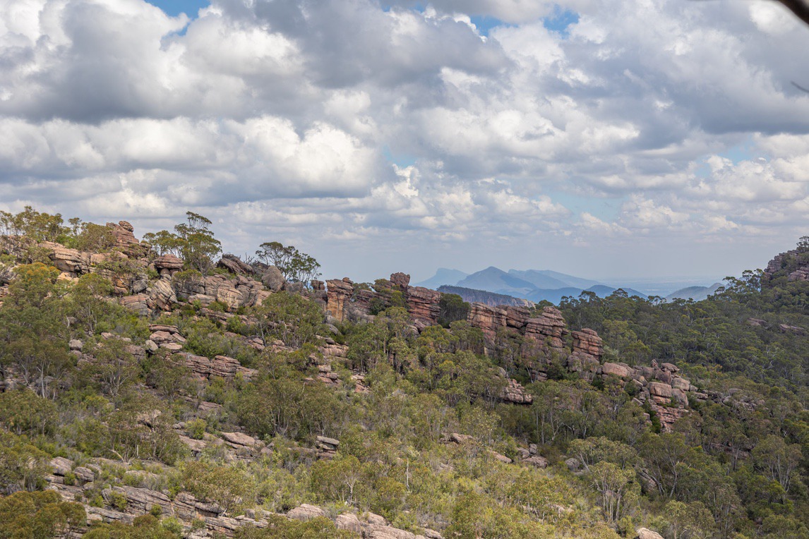
The new Grampians Peak trail is destined to become of Australia’s iconic walks, the 160km trail covers the length of the Grampians (Gariwerd) from the northernmost part of this incredible range at Mount Zero to the southernmost point at Dunkeld. Gariwerd has its own special energy that feels visitors feel and this is a thrilling journey through the heart of this timeless, heritage-listed National Park, showcasing so many spectacular vistas and dramatic peaks in this ancient and rugged landscape. It is a challenging trail in parts that is best suited to hikers with good fitness and experience.
If you’re after experiencing as much as you can of the new GPT’s accessible trail points and peaks then this is the right choice. Our 8-day self-guided trip offers many highlights of the trail. It takes in the very best of the accessible walking in the Northern, Central and Southern sections from the start of the trail at Mount Zero in the North to the finish at Dunkeld in the South. On the 8-day trip we also include the hike up Duwul / Mount Willliam (1167m) , which is the highest peak in the Grampians range and a worthy challenge for a fit and capable hiker.
Along the way you’ll discover historic Indigenous sites while traversing through rugged mountain ranges and in the valleys. With stunning vistas of the region’s flat plains and weathered escarpments around every corner, the Grampians Peak Trail really does provide a varied and enjoyably challenging walk. Our driver will provide you with a one-way transfer each day to the trailhead and you return with your own car (dropped on the way).
This journey will also give you the opportunity to gain insight into Jardwadjali and Djab Wurrung people, who know the Grampians as Gariwerd and have walked and lived in this area for thousands of years. The park is home to 80% of Victoria’s rock art and there is opportunity to visit one of the Indigenous shelters and rock art sites dotted throughout the area.
Please note: Prices quoted for self-guided trips are based on low season or standard rates. Travelling in peak periods or during public holidays may attract higher prices from local accommodations and suppliers and will be quoted on application.


Highlights
Grampians Peak Trail
- Highlights of the North, Central and South Grampians
- Dramatic walking on sandstone and granite escarpments
- Daily one-way transfers / own vehicle return
- Prolific wildlife and flora
- See the famous Taipan Wall, Pinnacles and Wonderland
- Challenge yourself with a climb up Duwul / Mount William
Itinerary
Daily Details
Your day begins at the northernmost point of the Grampians Peaks Trail at the Mount Zero Car Park. There is an option to climb nearby Mount Zero which takes you to the most northerly peak in the Grampians Range. This walk will add 2.5km to your day.
Start ascending the Grampians Peaks Trail to the top of Mount Stapylton. You’ll pass some incredible eroded rock formations and have views back over the plains. Continue along the escarpment until you descend through a gorge and towards the Stapylton Campground. You then return on an easy track passing through the Stapylton Amphitheatre looking up at the spectacular red cliffs of one of Victoria’s tallest and steepest former rock-climbing sites, the Taipan Wall.
Overnight: Halls Gap
Meals: L
This morning you begin at Stapylton Campground. You can start your day with an optional 1.1km walk to Ngamadjidj Shelter to see ancient rock art, one of the few art sites in the Grampians open to the public. After meeting up with the trail from yesterday’s walk, you begin a hike up to and over the ridgeline which will take you to Coppermine Track and road intersection and then climb up a fantastically eroded ridge, with great views of the central Grampians before you. Eventually, you will begin dropping down following a tributary of Briggs Creek and passing by Barigar Hikers Camp. From here it’s a further 4km to your finish at Roses Gap Road. You’ll pass striking orange and grey cliffs and have wonderful views of the imposing Mount Difficult Range in front of you.
Overnight: Halls Gap
Meals: B, L
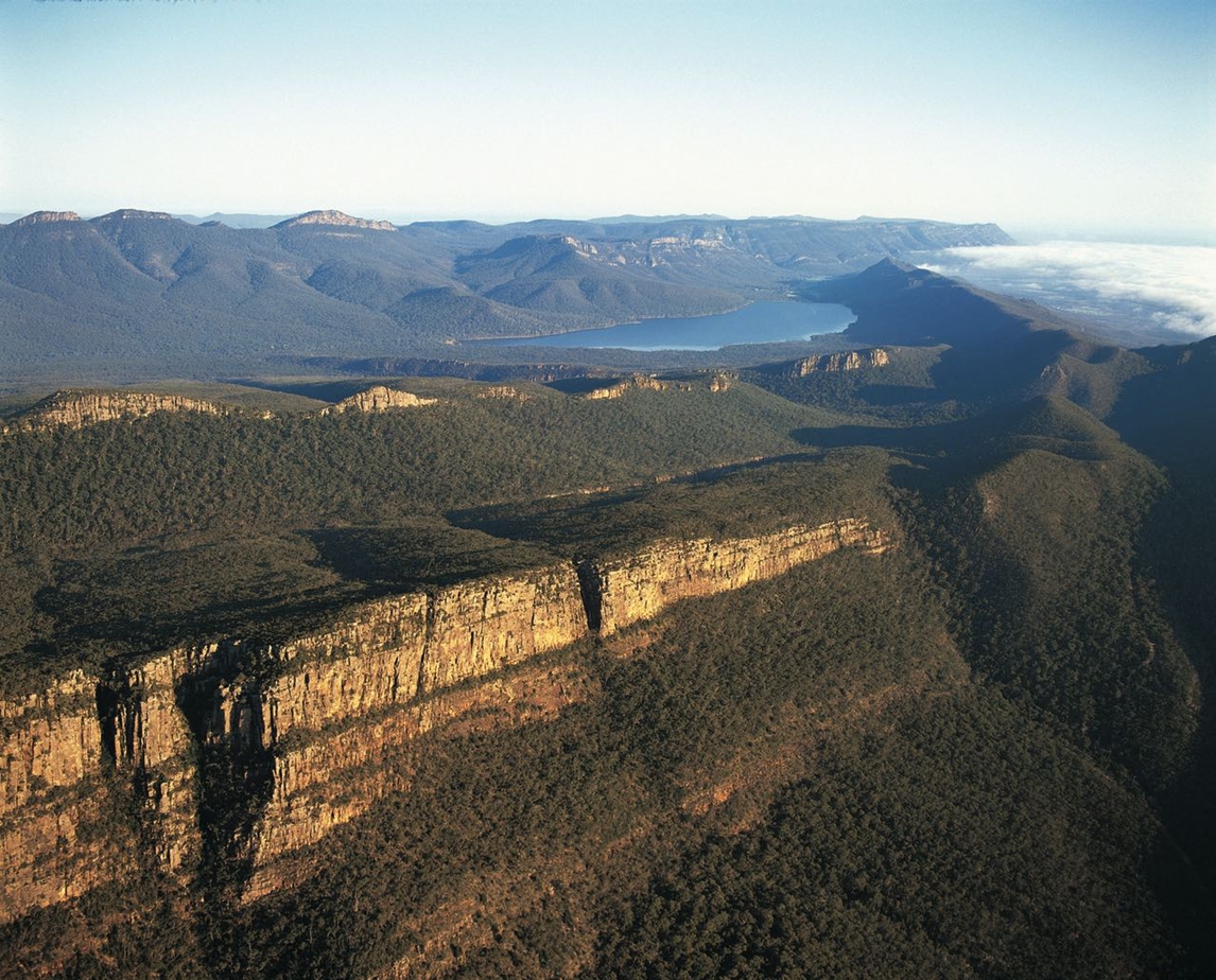
Today starts with a transfer to near Werdug Hikers Camp and then a climb to Lake Wartook Lookout. At 829m, it is one of the highest points in the Mount Difficult Range and offers incredible views of Mount William and the Black Range in the distance and the evocatively named Asses Ears Mountains and Wartook Basin below.
After descending back to Mount Difficult Road you cross over onto the eastern side of the range again, skirting cliffs with views of the plains below. Then you begin a steep descent on a stone staircase through a pass in the cliffs and walk through a forest of messmate stringybark which after several kilometres brings you to Chatauqua Peak and Clematis Falls – both short side trips where you can take your lunch. The last section descends you down into Halls Gap and your centrally located accommodation in town.
Overnight: Halls Gap
Meals: B, L
NOTE: If you are a group of 5+ then we will need to substitute this day for another on the Grampians Peaks Trail, such as the Griffin to Cassidy Gap Road section (11.5km) or another suited to your group’s desire and ability. (The dirt road on this day to Werdug is not suitable for the buses we use for groups.)
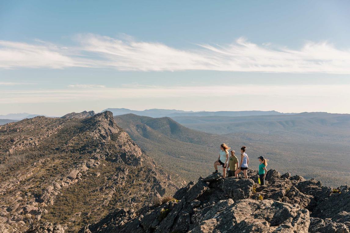
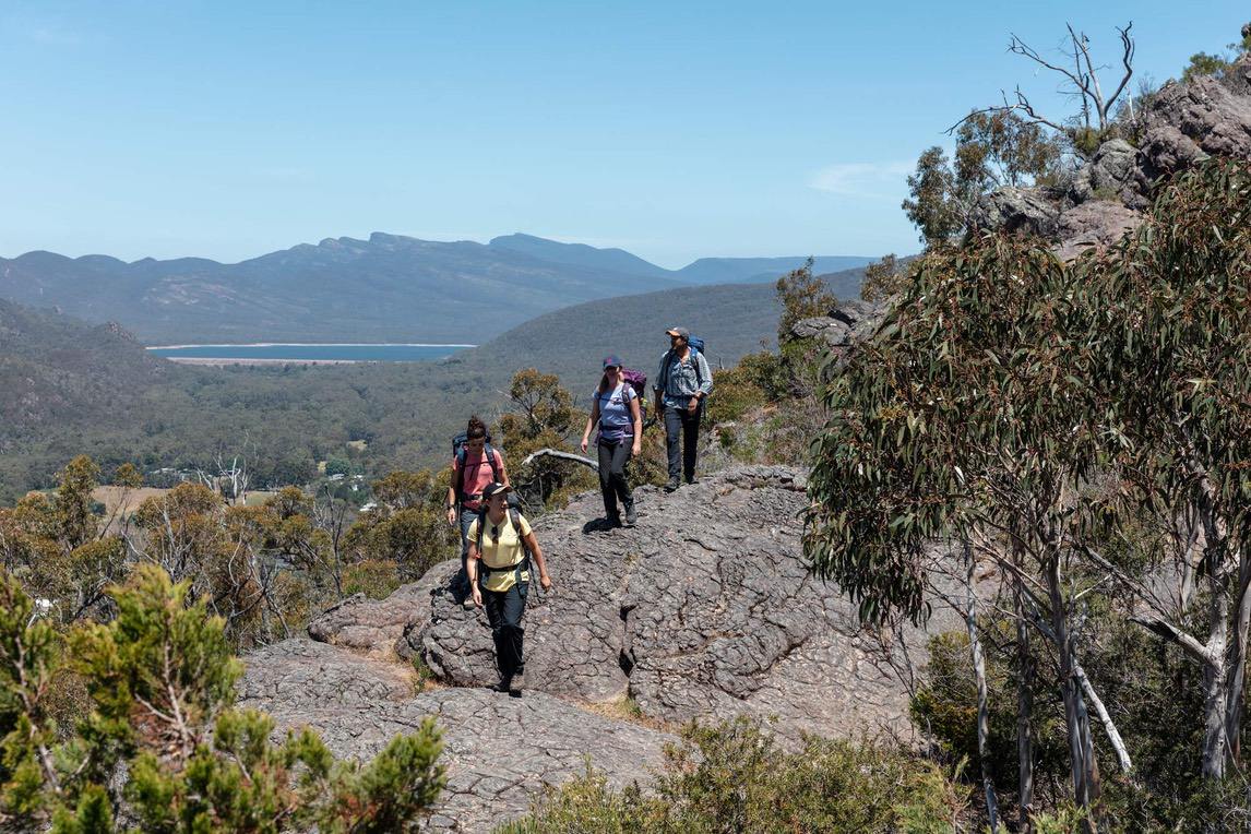
Today you can start your walk straight from the centre of Halls Gap as you tackle the central Grampians. The trail starts with a climb via Venus Baths and continues on towards Splitter Falls. After viewing the falls, return to the main track and continue on to the Grand Canyon and Wonderland. (The track through the Grand Canyon is closed due to storm damage; there is a diversion in place.) After the steep climb to the impressive rock formations, continue on through rocky woodland and the narrow rock canyon known as Silent Street to the famous Pinnacle Lookout. Perched on the very edge of the range, the views from the lookout over the Grampians and Mount William are magnificent.
Continue south following the signs to Lakeside Lookout. There is an option to add on a walk to Sundial Peak Lookout, which is an additional return walk of 3.4km (1 hour 15 minutes) before returning and continuing to the Rosea Car Park which is the finish of today’s hike. Today’s route offers stunning views, with some steep ascents, rocky sections and walking through some narrow rock tunnels.
Overnight: Halls Gap
Meals: B, L
Today is a long and spectacular day of walking to Redman Bluff (1017m) and then Mount William, the highest of the Grampians peaks (1167m). You’ll be dropped at the Redman Road Trailhead from where the trail ascends through dense woodland to the Seven Dials. Get ready for some boulder scrambling as you traverse these rugged granite outcrops. You then meet the Grampians Peaks Trail and climb towards the cliffs of Redman Bluff, marked by a historic rock cairn. There are superb views all around of the Grampians Range and you’ll catch sight of the deep valley that flanks the side of Mount William. Walk down from Redman Bluff and hike a small corridor between the Mount William Road and the deep valley below before reaching Duwul Hikers Camp. From here, continue on a short distance to meet the Mount William Road and Car Park.
If you still have the energy, there is an additional 4.4km return walk to the summit, which is on a sealed road. Rising to 1167m, Mount William is the tallest peak in the Grampians. Stunted eucalyptus trees give way to breathtaking 360-degree views of jagged mountain ranges and open plains. In the later afternoon light you’ll see the landscape saturated in beautiful colours.
Overnight: Halls Gap
Meals: B, L
IMPORTANT: This is a rugged walk in parts. It involves pulling yourself up and over large boulders in the earlier sections and it’s physically demanding to complete the day’s ascent to Mount William. You need to be a very fit and confident hiker. If you are unsure of your ability to walk all of this day up to Mount William then we can shorten the day by a few kilometres by cutting in on the fire track from Redman Road (on the Seven Dials Track) and avoiding the obstacles of the Seven Dials outcrops where a lot of the more difficult sections lay. The Seven Dials fire track is not part of the Grampians Peaks Trail itself but provides a useful cut-in to meet the Grampians Peaks Trail and avoid the harder, earlier part of the day leading from Redman Road Trailhead to the Seven Dials Track.
Or see our 7-day walk instead which cuts out this day.
The Grampians Peak Trail meets Yarram Gap Rd which is the start point for today’s walk. There is a water tank on the left. Make sure you use the boot cleaner before heading on to the GPT through open woodlands of native cypress and grass trees taking in the views to the Serra Range and once you’ve come to the hillcrest you will have views back towards the Mt William Range. The track is rocky underfoot as you walk along the ridge up and over 6 knolls and saddles passing marker GNP253. From the top of the ridge you’ll have views to Signal Peak and Mt Abrupt and this is a great spot for a lunch break.
Coming off the ridge you’ll descend on a rocky path through forest and in the distance you will see open grasslands in the valley. The path makes it’s way down and once in the valley you will be in pasture land populated by mobs of kangaroos. If you take the right-hand turn at marker GNP234 this will take you to Wannon Campground which has toilets, a water tank and an open area gathering place, a lovely place to sit and watch the wildlife.
From Wannon Camp continue for another 3kms crossing over the Wannon River to finish at GriffinTrailhead.
Overnight: Dunkeld
Meals: B, L
This morning you will explore the southernmost section of the Grampians and one of the peaks that is visible from Dunkeld. You start with a road transfer to the Piccaninny Car Park where you’ll walk a few hundred metres to rejoin the Grampians Peaks Trail as it climbs up around the back of the Piccaninny Peak, with an option to climb to the summit (448m). Descend from the Piccaninny for approx. 1km to cross the Victoria Valley Road and start an ascent of nearby Mount Sturgeon, the first peak at the very southernmost edge of the Grampians Range. After climbing 2.5km up the trail to the summit (582m) you can enjoy wonderful views of the Serra Range to the north and Dunkeld to the south, before descending on the trail in the direction of Dunkeld. The last section of the walk is easy going, meandering through red gums by the Wannon River to reach the town. Enjoy lunch in Dunkeld.
Alternate longer option: Mount Abrupt
If you are feeling energetic and would like an additional challenge today, there is the option to extend your walk and instead begin your day by being dropped at the Mount Abrupt Car Park, a little further away from Dunkeld (talk to your driver the day prior to arrange this). There is a steep climb to the iconic summit of Mount Abrupt, the most imposing peak in the south, which offers fantastic views. From the summit of Mount Abrupt you continue the Grampians Peaks Trail southwards for several kilometres to reach the Piccaninny Car Park and begin the 11.1km route described above. Adding this option with Mount Abrupt would mean another 8.9km to reach the car park at the Piccaninny and a long, strenuous day of 20km with three peaks and an estimated 8 to 9 hours. It’s not to be underestimated, and an early start is required. Don’t attempt this unless you are very fit and have adequate time and daylight hours.
Overnight: Dunkeld
Meals: B, L
Enjoy a leisurely breakfast this morning. We recommend visiting the beautiful Dunkeld Arboretum and strolling down the charming main street of this lovely town. Once you check out of your accommodation, your trip is at an end. We ask that you return your PLB to our Halls’s Gap drivers office.
Meals: B
Map
Explore
Halls Gap
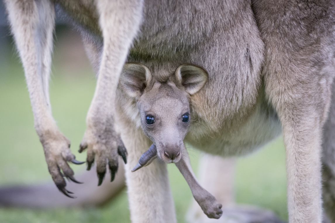
The delightful township of Halls Gap is the gateway to the Grampians (Gariwerd) National Park and offers breathtaking views of the sandstone mountains. It’s used as a base to access the many hikes in area and has a good selection of accommodation, eateries and shopping for any supplies you might need. There’s inquisitive wildlife too, including emus, wallabies and birds.
CLICK ON A PIN TO REVEAL INFORMATION ABOUT THAT LOCATION
Pinnacle Lookout
The iconic Pinnacle Lookout is one of the most spectacular vantage points in the Grampians. The rocky outcrop, perched on the very edge of the range, offers magnificent views over the Grampians and Mt William.
Mount William (Duwil)
Rising to 1167m, Mount William (Duwil) is the Grampians’ tallest peak. It provides incredible 360-degree views of mountain ranges and open plains. As you make your way to the summit, tall eucalyptus trees on the lower slopes give way first to dwarfed trees and then to low, windswept bushes and grasses.
Dunkeld
The picturesque township of Dunkeld offers striking views of Mount Sturgeon and Mount Abrupt. Attractions include the 18-hectare Arboretum and the acclaimed Royal Mail Hotel, a destination in itself.
Mount Sturgeon (Wurgarri)
Mount Sturgeon (Wurgarri) is 582m and the first peak at the very southernmost edge of the Grampians range. From the summit there are wonderful views of the Serra Range to the north and Dunkeld in the south.
The Piccaninny (Bainggug)
On the way to the summit (448m) of The Piccanninny (Bainggug) you’ll walk through picturesque open forests that showoff colourful wildflowers in spring. From the summit there are breathtaking views of Mount Abrupt (Mud-Dadjug) and Dunkeld.
Mount Abrupt (Mud-Dadjug)
There is a steep climb to the iconic summit of Mount Abrupt, the most imposing peak in the south. It offers fantastic views back along the Serra range northwards and south to Dunkeld.
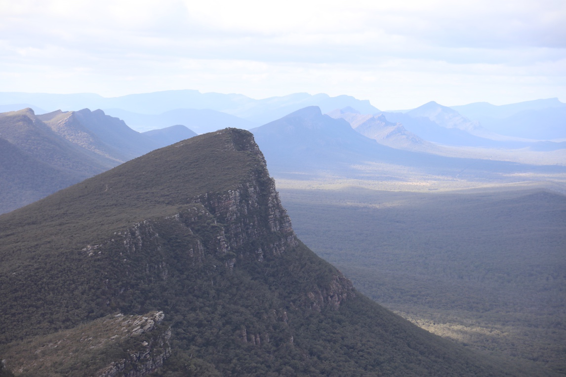
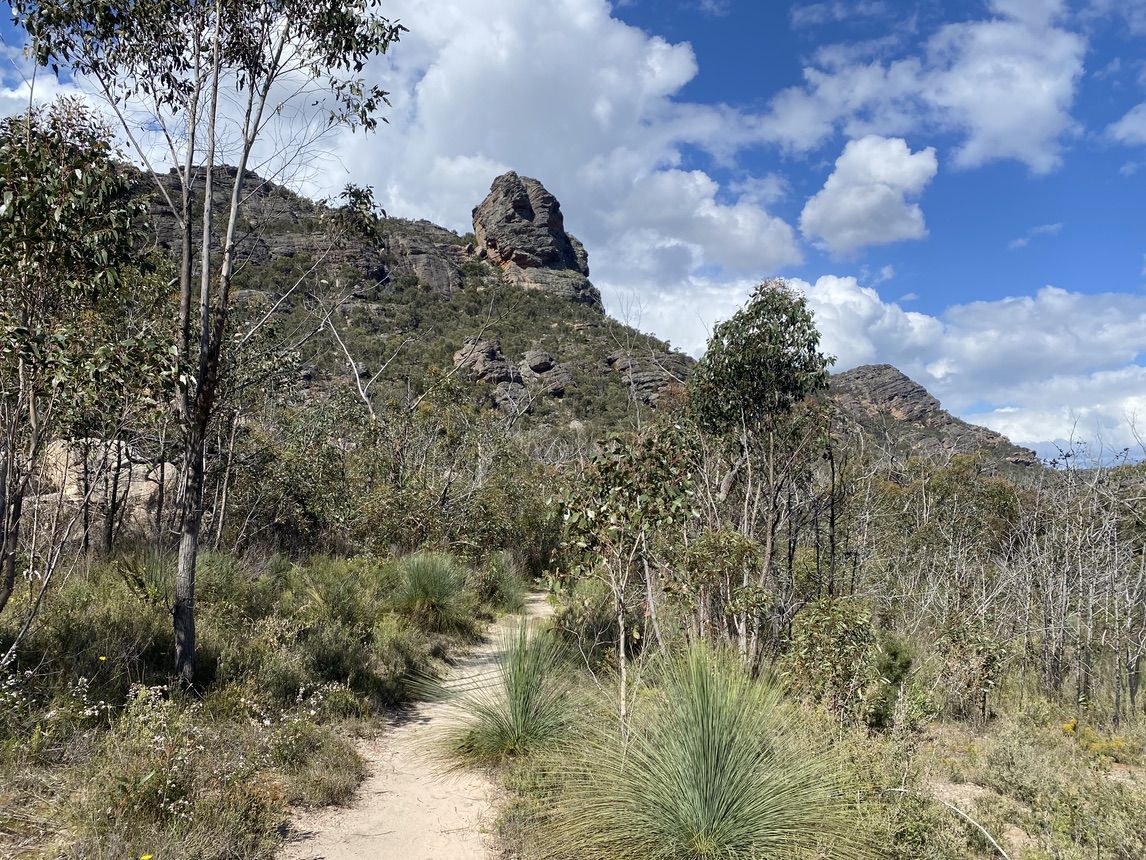
Mount Stapylton (Gunigalg)
Mount Stapylton (Gunigalg) is 518m above sea level and the view from the summit is spectacular, taking in much of the park and surrounding plains. On the descent through the Stapylton Amphitheatre you’ll see the spectacular red cliffs of one of Victoria’s tallest and steepest former rock-climbing sites, the Taipan Wall.
Lake Wartook
The lookout (829m) at Lake Wartook is one of the highest points in the Mount Difficult range. It offers incredible views with Mount William and the Black ranges in the distance and the evocatively named Asses Ears Mountains and Wartook Basin below.
Mount Zero (Mura Mura)
Mount Zero (Mura Mura) is the northernmost mountain of the Grampians range. The peak was named by Thomas Mitchell in 1836 because the temperature was 32 Fahrenheit (0 degrees Celcius) at dawn on the morning of the ascent.
Inclusions
What's Included?
- Twin-share accommodation in an ensuite room
- 5 nights in Halls Gap hotel, 2 nights in Dunkeld B&B
- 7 cooked breakfasts, 7 packed lunches
- Personal locator beacon for the duration of your trip
- Daily trailhead transfers (one way) and local support driver
- Pack of 3 Grampians hiking maps 1:50,000 scale
- RAW’s unique walking app for real-time navigation on trail
- National park fees
- Carbon offset for your trip and an Australian tree planted on your behalf
- 10% GST included
- Weekend surcharges may apply at time of booking
- Breakfast on day 1 and lunch on day 8
- Dinners each night, selection of local restaurants to choose from
- Travel insurance
- Additional transfers
- Transport to / from Halls Gap
- Alcohol with meals

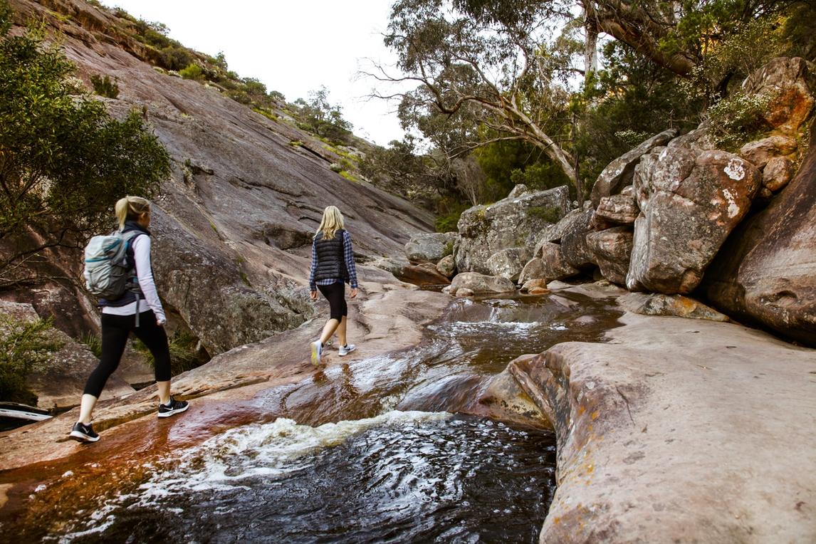
On the trail
The Experience
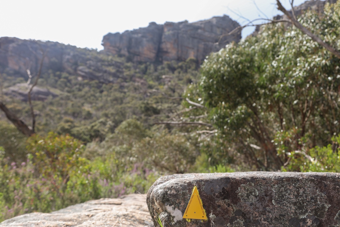
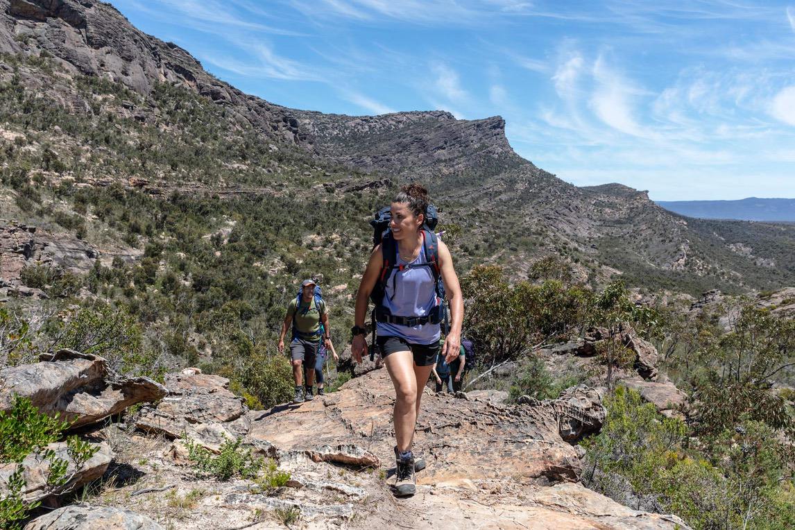
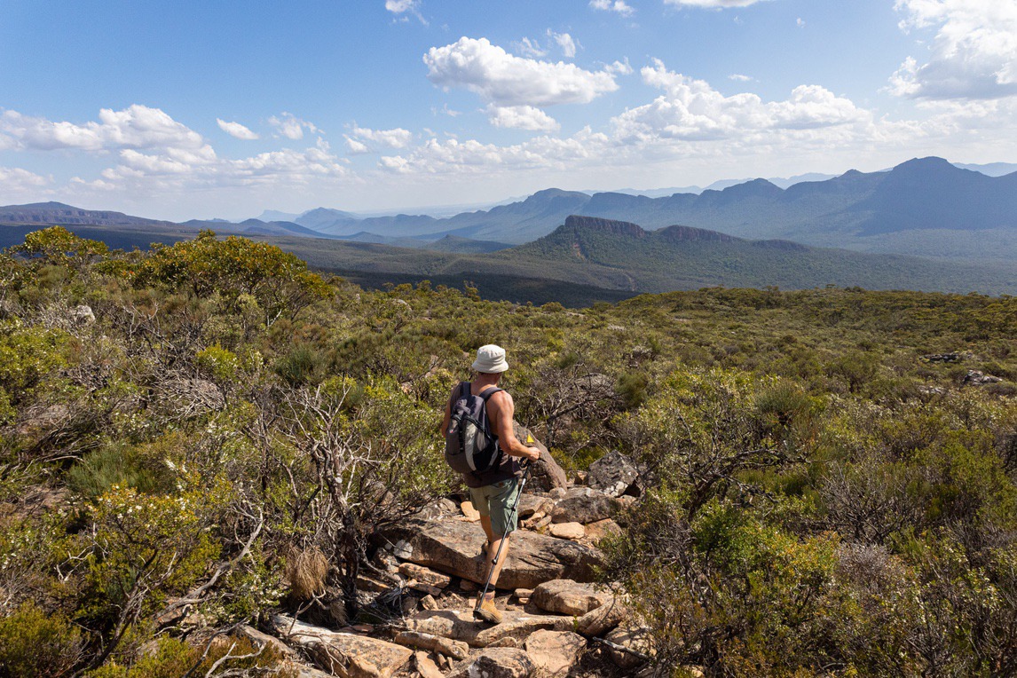
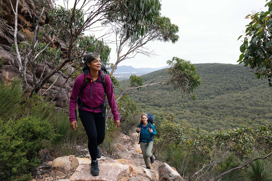
The Grampians Peaks Trail is extremely varied, with some high cliffs, steep slopes and descents, stone staircases, rocky platforms, sandstone outcrops, forest gullies, dirt tracks, sealed walking tracks and bridges. You will need to have a good level of fitness for the ascents and be comfortable with climbing up and over stacked granite rocks, squeezing through boulders, hopping over streams after rain and through exposed rocky areas. There are some steep sections of walking as we ascend peaks such as Mount Abrupt. The trail is well marked with signs and yellow trail markers along the way.

WALKING APP
FINDING YOUR WAY
Our unique RAW Travel walking app has been designed to help you navigate easily on the trail, so you never get lost. Simply download your map with the unique link we send you and you’ll be able to follow your route with ease, showing your location in real-time without any internet connection needed. The app has many great features; it shows you weather forecasts localised for each of your overnight stops, information on the location of each night’s accommodation. There are important reminders, safety information, videos and emergency contact information for your route. It also has a unique audio feature that can tell you about places and points of interest as you approach them on the trail.

Exclusive Guide
Grampians Peaks Trail
More than a decade in the making, Victoria’s Grampians Peaks Trail is destined to become one of Australia’s iconic walks. On this trail, you will be rewarded with some of the best hiking trails and panoramic views in Australia. And with our unique itineraries, you don’t have to tackle the entire 160km. The trail extends over the ancestral lands of the Djab Wurrung and Jadawadjali people, and Parks Victoria has worked with traditional owners to guide the trail alignment and shape visitor information and stories. Discover inspiration, travel essentials, practical information and more in our free Destination Guide.
")
TO/FROM YOUR WALK
Daily Transfers
If you do NOT have a car, your driver will transfer you to / from the start and end point of your walk each day (this will incur additional transfer costs as only one-way transfers are included). If you DO have a car, you can drive and park your car at the start or end point of each day’s walk. If you leave your car at the start point, your driver will meet you at the end of your walk at a designated agreed time and transfer you back to your car each day. If leaving your car at the endpoint, your driver will meet you each morning at the endpoint of that day’s walk and transfer you to the start of the trail. You can then drive yourself back to your accommodation at the end of your day’s walk.
Experience tells us leaving your car at the END point of each day’s walk is the most convenient as it saves time waiting for a pick-up, therefore allowing you more time to enjoy the area.
FAQs
Need to Know
This walk is challenging due to the ascents and descents involved, plus navigating your way over the rock plateau and narrow rock defiles in some places. The walks are mostly listed as Grade 4 by Parks Victoria with some sections as grade 3 and the odd section as grade 5 ( mostly avoided on our trips). It’s best suited to hikers of reasonably good fitness and confidence on a trail. See the notes on the itinerary for day 5 for the Mt.William ( Duwul) climb as this is the most challenging day.
Grade 4 hike definition: Recommended for experienced hikers and a reasonable level of fitness. A grade 4 hike includes rough ground and very steep sections. These trails are suggested for people with experience hiking. They may be any length, but physically more demanding.

Positive impacts
Social and environmental
All our adventures are fully carbon offset so that you know your travel has minimal impacts. Hiking itself is a low impact activity but we offset the cost of all our office operations and food production as well, so you can be satisfied that you have chosen a form of travel that is both good for you and good for the planet. Each year we also plant trees on behalf of every customer who has travelled with us, aiming to build towards a carbon positive effect with our operations.
As a B-Corp a focus on local community is an important part of who we are. We are committed to buying locally and source our produce from growers here on the Mornington Peninsula. We care about people in our community and for every meal pack you buy with us we donate a meal to a homeless support charity, to spread some love and share good food with those who need it most.

Australia – Guided walks
Grampians Peaks Trail 5 day highlights: Guided
- 5-day guided highlights of the Grampians Peaks Trail
- Walk Northern, Central and Southern sections and peaks
- Stay in central location accommodation in Halls Gap
- Walk waterfall trails and mountain peaks
$2,490.00

Australia – Self Guided Walks
Grampians Peaks Trail 5 day Self-Guided
- 5-day self-guided highlights of the Grampians Peaks Trail
- Walk the Northern and Central sections and peaks
- Stay in comfortable accommodation in Halls Gap and Dunkeld
- Daily trail transfers, PLB, maps and navigation app included
$1,550.00

Australia – Self Guided Walks
Grampians Peaks Trail 7 day Self-Guided
- 7-day self-guided highlights of the Grampians Peaks Trail
- Walk Northern, Central and Southern sections and peaks
- Stay in comfortable accommodation in Halls Gap and Dunkeld
- Daily trail transfers, PLB, maps and exclusive navigation app included
$1,990.00

Australia – Self Guided Walks
The End to End Self-Guided Trip – Great Ocean Walk
- Walk the full length of the Great Ocean Walk
- Entry to the Cape Otway Lightstation
- Emergency satellite messenger beacon
- A moderate challenge from Apollo Bay to Twelve Apostles
$2,895.00

Mornington Peninsula
Mornington Peninsula Full Circuit – Self-Guided
- Experience the 100km Mornington Peninsula Walk
- Climb over the famous vantage point of Arthur’s Seat
- Take in the beautiful bay villages of Portsea and Sorrento
- Arthur’s Seat, Mornington National Park, Cape Schanck Coast, Point Nepean National Park
$2,250.00
TRIP date selection
when would you like to travel?
Please select your preferred dates for on-demand trips or select a scheduled date for group departures. If you have booked a self-guided trip please understand that because your trip date is on demand and we must check availability of all properties on your chosen dates before it can be fully confirmed